Waccamaw Indians

The native Waccamaw tribe were among the first inhabitants of this region. They were a small river dwelling people, settling along the Waccamaw River from Lumber River, North Carolina to Winyah Bay near Georgetown. They called the area “Chicora”, which means “the land”; this term is still used by locals to describe the area. The native tribe thrived for thousands of years, until Spanish explorers arrived in 1526, establishing a small colony, which was devastating for the Waccamaw, as they quickly succumbed to smallpox and other diseases brought by these colonial settlers. Waccamaw members currently number around 400 members and continue to live in in the area near the river called “Dog Bluff”.
Revolutionary War / Georgetown Area

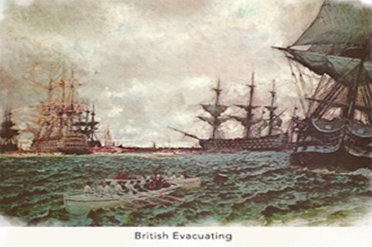
Georgetown, the third oldest city in South Carolina, was a designated port of entry in 1732. This status quickly made it a thriving city for trade and through Revolutionary War and Civil War, Georgetown flourished. Before the American Revolution, the British paid a high price for indigo, enabling many planters to make a quick fortune. British troops occupied Georgetown during the Revolution from July, 1780 to May, 1781. At the close of the war, Maj. Gen. Alexander Leslie agreed not to destroy the city if the Americans would allow his troops to depart safely. Upon the firing of the morning cannon the British, their allies, their Loyalists, and 5,000 slaves moved out, while the Continentals of Maj. Gen. Anthony Wayne moved in – keeping a respectful distance. After the Revolution was over growing indigo was no longer profitable and most planters returned to production of rice as their major crop.
Plantation History
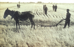 By 1840, Georgetown was one of the major rice producing areas, producing almost half of the total rice grown in the US. It also became the world’s largest rice-exporting port in the world. “Carolina Gold” rice was high in demand worldwide and planters made their fortunes growing this local variety, until the Civil War. This time of war, reconstruction and general upheaval, paired with crop failures and devastating hurricanes, saw the end of the rice plantation in the Georgetown area.
By the early 1900’s, lumber became the main economy, with the Atlantic Coast Lumber Company building the largest lumber plant on the East Coast until 1932. After the Great Depression, the production of paper and steel became the primary industries in the area. Commercial fishing and tourism are also important to the area now as well.
Pawleys Island
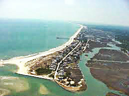
Hot and humid summers, along with mosquitoes, led wealthy planters who were located on the rivers to seek relief at the coast. Each May, plantation owners and their families relocated along the shore for what became a leisurely summer ritual, free of mosquitoes and summer illnesses. Plantation families built fine homes with gabled roofs and wrap around porches made from heavy hand hewn lumber on the island. Many of these homes are so sturdy that they have withstood hurricanes and tropical storms; many remain standing today. The island is nicknamed “arrogantly shabby” and has changed little since the 1700’s, with many of those antebellum homes now owned by 3rd, 4th and 5th generation family members. Though the rest of the Grand Strand quickly developed into a major tourist area in the early 20th Century, Pawleys Island remained relatively undeveloped. Cypress sided cottages dominated the island until Hurricane Hugo swept many away in 1989. There is still a ban on large commercial buildings on the island as well, except for a few building grandfathered in. Pawleys Island is a rare find along the east coast, as one of the most quaint and relaxed of the islands.
Old Kings Highway
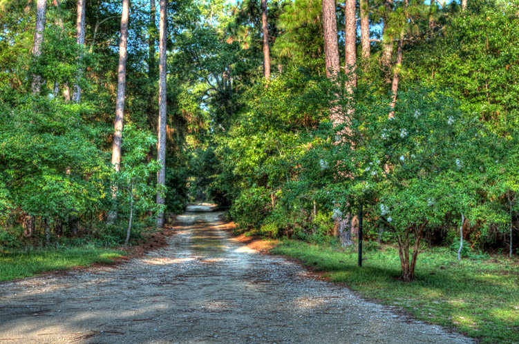
The original Old Kings Highway ran North and South through the riverside of Prince George and was named after King Charles II. It began as an Indian Trail long before European settlers arrived in the area. In 1791, George Washington traveled down the Old Kings Highway in the unincorporated area of Pawleys Island to visit plantation owners in the area. Later, this trail became a route to Charleston and Savannah from the northern states. The entire length of The King’s Highway did not become a continuous wagon road until about 1735, from Boston, Massachusetts to Charles Town, South Carolina. Now, it is a major thoroughfare through the Grand Strand/Myrtle Beach area.